Geotechnical investigations are necessary to obtain information about the physical properties of soil earthworks and foundations for proposed structures.
Geological Investigations should be conducted for new projects and reviewed for existing structures to determine the general geologic setting of the area at and near the project. This is also done to determine the geologic conditions related to the selection of the site and the characteristics of the foundation soils and rocks.
The geotechnical investigation involves the following:
- Planning of a program for investigation
- Collection of soil or rock samples from the holes drilled in the field.
- Conducting all necessary tests for determining the strength and compressibility characteristics of the soil.
- Study of groundwater conditions.
- Preparation of charts, drawings etc.
- Analysis of the data
- Report Preparation
A geotechnical investigation includes surface exploration and subsurface exploration of a site, identify mineralogy, petrology, and obtain information about tectonic conditions.
Surface exploration comprises determination of erosion pattern, deposition characteristics. For surface exploration, any sophisticated instrument or modernized method is not required.
Types of Geotechnical Investigations:
The geotechnical investigations are generally carried out in two stages:
- Preliminary Stage: In this stage, we do a geological study of the site and the site reconnaissance.
- Detailed stage: In this stage, nature, sequence and thickness of various subsoil layers, their lateral variations, physical properties, the position of groundwater etc. are done.
Depth of Exploration:
As s general rule, unless bedrock is encountered, boring should be carried out to such a depth that the net increase in stress in the soil mass due to the superimposed external load is less than 10%.
IS Code recommends a depth of exploration to one and a half times the width of footing for isolated/raft footing and ane and half times the width of structures for pile and well foundation.
Methods of Geotechnical Investigation
Test Pits:

It permits visual inspection of the subsurface condition in a natural state. This is useful for gravelly soil. In this sampling and testing are done on the exposed surface. Test pits are an economical method of soil exploration to a shallow depth. In this method, a square shape pit is excavated and soil samples are collected at the required depth. Pits can be excavated manually with crowbars by labour. Tractor and some mechanical excavators can also be used to make exploration faster and economical. This method is also used to identify weaker materials or any lenses.
Percussion Drilling:
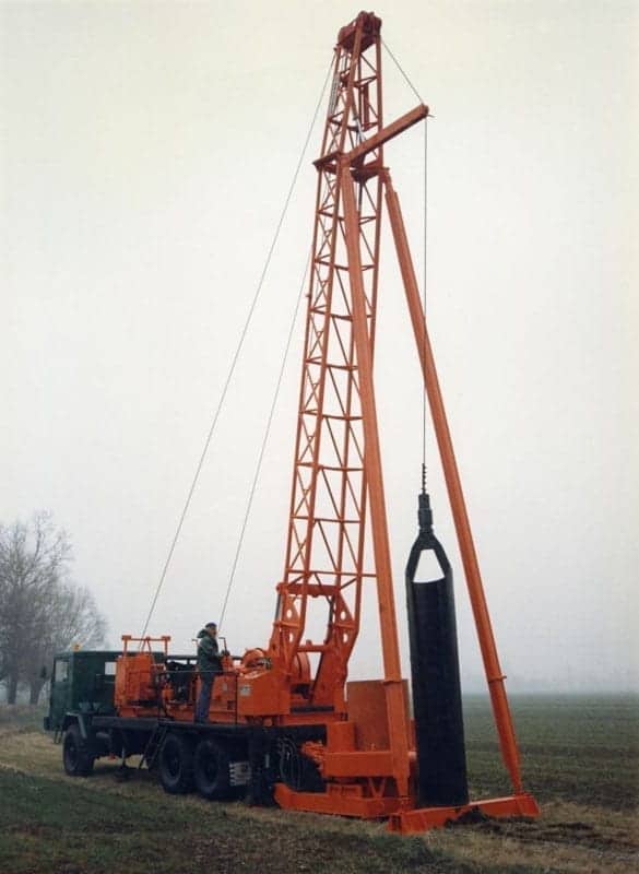
In this method, a heavy cutting or hammering bit attached to a rope or cable is lowered in the open hole or inside a temporary casing. Water is added to the well hole so that the steel bit makes mud out of the earth it has cut. After the hole is filled with mud the heavy bit is withdrawn and a tool bailer is attached to the rope and lowered into the hole. The flap valve opens when hit the mud to allow the mud to fill the bailer and then closes to trap the mud. And then the procedure is repeated again. Percussion drilling is applied for research on soil pollution, grain size distribution, general soil classification, profile description.

Probing or Sounding methods:
This method is used to measure resistance offered by soil. It is a type of resistivity investigation. This is done to detect lateral changes in resistivity. It predicts the change in subsurface lithology. This is used to determine the vertical changes in resistivity.
Geophysical method:
The two commonly used geophysical methods are:
- Seismic Refraction Method: In this method, a shock wave is generated either by striking a plate on the soil with the hammer or by exploding a charge. Since the seismic wave has different velocities in different types of soil or rocks, the waves get refracted when they cross the boundary between different types of soil. By recording the radiating wave by geophones installed at suitable known distances, the soil type and approximate depth is determined.
- Electrical Resistivity Method: This method is based on the measurement and recording of changes in the mean resistivity of various soil.

