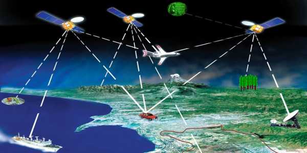
A Geographical Information system (GIS) is a tool, which can accept large volumes of spatial data derived from a variety of sources, retrieve, manipulate, analyse and display them according to user-defined specifications.
A Geographic Information System is
- Organized collection of Hardware, Software, Network, Data, People, andProcedures
- Software Product-Tool for solving geographic problems
- Supported by data set/databases.
- Used by people working with geographic information and tools.
- The container of maps.
- Help to automate time-consuming tasks.
Evolution of GIS
It is innovated in 1960-70. Roger Tomlinson’s developed the Canada Geographic Information system resulted in first computerized GIS in the world in 1963. In 1965 Howard Fisher established the Harvard Laboratory for Computer Graphics. In 1969 Major vendors started(example:- ESRI, Intergraph.
In the 1980s it was Commercialized. After 1980s first commercial GIS software (e.g. ArcInfo) launched. As computing became more influential, Esri upgraded its software tools. Esri’s work gained recognition from the academic community as a new way of doing spatial analysis and planning. In need of analyzing an increasing number of projects more effectively,
In the 2000s, the Internet became a major delivery vehicle.
GIS Nowadays: GIS helps to create own digital map layers to help solve real-world problems. GIS has also evolved into a means for data sharing and collaboration, inspiring a vision that is now rapidly becoming a reality—a continuous, and compatible GIS database of the world, about virtually all subjects. Today, hundreds of thousands of organizations are sharing their work and creating billions of maps every day to tell stories and reveal patterns, trends, and relationships about everything.
Five M’s Of Applied GIS
Mapping is an analysis technique that typically employs software capable of rendering maps processing spatial data, and applying analytical methods to terrestrial or geographic datasets,
Measuring is used to determine the locations of objects, to the function f, and to the rules used to determine interpolated positions
Monitoring is a powerful management tool that can be used to improve the way governments and organizations achieve results
Modelling is a mathematical construct for representing geographic objects or surfaces as data
Managing includes customer support, operations, data management, and application development and support
GIS Applications
- Predicting the position of administrative boundaries.
- Location of infrastructure facilities.
- Routing of Vehicles.
- Management of Natural resources.
- Monitoring of development Schemes.
- Asset Inventories
- Transportation planning
- Cadastral Information system.
- Natural resources management
- Utility planning and management
- Disaster Mitigation
- Environmental impact assessment
RDBMS
RDBMS stands for “Relational Database Management System.” An RDBMS is a DBMS designed specifically for relational databases.
Associated non-spatial attributes of spatial objects are stored using RDBMS tool.
GIS supports query linking spatial and non-spatial databases.
Spatial databases in GIS
Spatial databases provide a strong base for accessing, storing and managing contiguous data. A database is a collection of related information that allows the entry, storage, input, output and organization of data.
A database management system (DBMS) serves as a connection between users and their database. A spatial database includes location. It has geometry as points, lines and polygons.GIS combines spatial data from many sources with many different people. Databases connect users to the GIS database.
GIS just like other projects needs clear objectives, Project Orientation, Focused time scales, Risk management, Effective Communication.
The Use Of GIS in Management
Geographic is a great framework for organizing and managing resources, events, people etc.
Cross-cutting, interdisciplinary approaches needed to solve many real-world problems
GIS can help
- Integrate data from multiple resources.
- Record how events change over space and time.
- Communicate results effectively
- Model alternative geographic scenarios.
Involvement of GIS in society
GIS can also be misused to warp reality for individual and political gain. It has been asserted that the production, distribution, utilization, and representation of geographic information are largely related to the social context and has the potential to increase citizen trust in government.
Other related topics include discussion on copyright, privacy, and censorship. A more cheerful social approach to GIS adoption is to use it as a tool for public participation. At the end of the 20th century, GIS began to be recognized as tools that could be used in the classroom.
Read more:
GPS and GIS – Definition, Components and Application in Civil Engineering


